Geomatics 2024, 4(2), 173-188; https://doi.org/10.3390/geomatics4020010 - 17 May 2024
Abstract
Scour around bridges present a severe threat to the stability of railroad and highway bridges. Scour needs to be monitored to prevent the bridges from becoming damaged. This research studies the feasibility of using green laser for monitoring the scour around candidate railroad
[...] Read more.
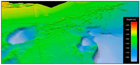
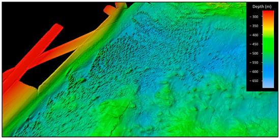
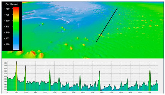
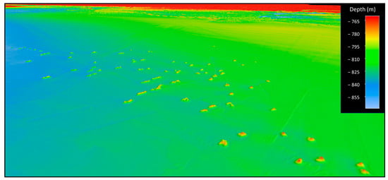
Scour around bridges present a severe threat to the stability of railroad and highway bridges. Scour needs to be monitored to prevent the bridges from becoming damaged. This research studies the feasibility of using green laser for monitoring the scour around candidate railroad and highway bridges. The laboratory experiments that provided the basis for using green laser for underwater mapping are also discussed. The results of the laboratory and field experiments demonstrate the feasibility of using green laser for underwater infrastructure monitoring with limitations on the turbidity of water that affects the penetrability of the laser. This method can be used for scour monitoring around offshore structures in shallow water as well as corrosion monitoring of bridges.
Full article


